
What are the Basics of GPS Technology in Fleet Management?
GPS, or Global Positioning System, is a satellite-based navigation network that determines a device’s exact location anywhere on Earth. It works by using a network of satellites that continuously transmit signals containing their position and the current time.
A GPS receiver in a vehicle picks up signals from at least four satellites, then calculates its own position through a process called trilateration.
The system can determine location to within a few metres, and when connected to a fleet tracking platform, it provides real-time visibility of every vehicle in the fleet.
GPS technology operates independently of mobile networks, which means it can function in remote areas, although transmitting the data to fleet management software may still require a mobile or satellite connection.
This technology forms the foundation of all modern fleet tracking systems.
What does Installing a GPS Tracking Device Mean?
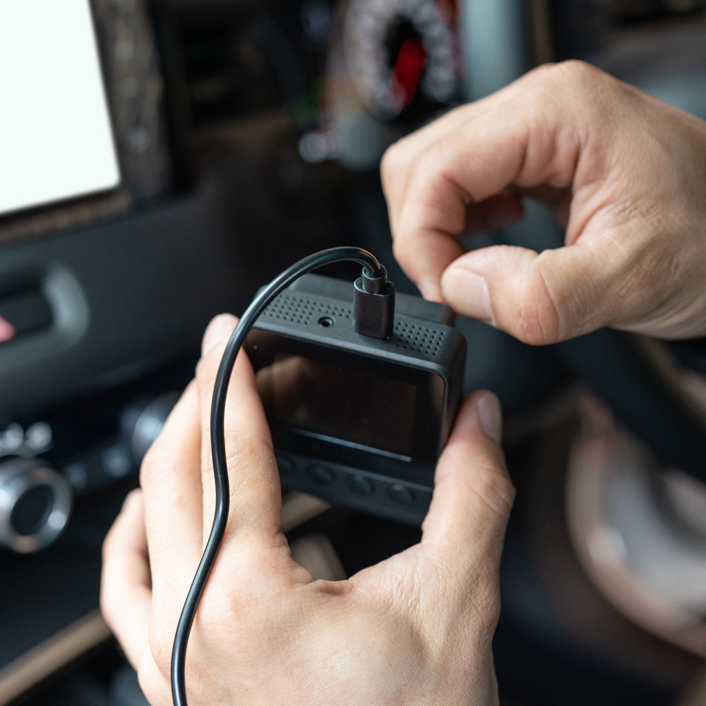
Installing a GPS tracking device is the first step in enabling fleet tracking. Devices are typically small, durable units that can be hardwired into a vehicle’s electrical system or plugged into the OBD-II port for a simpler setup.
Hardwired units are more secure and less prone to tampering, while plug-in units are faster to install and move between vehicles.
Some devices are self-powered with internal batteries, making them ideal for assets without a constant power supply.
The installation process includes mounting the device in a secure, discreet location to protect it from damage, then connecting it to the vehicle’s power source.
Once installed, the device is paired with the fleet tracking software so it can start transmitting location and performance data.
Professional installation is recommended for hardwired units to ensure reliability and compliance with manufacturer guidelines.
How is Fleet Tracking Data Transmitted
Once a GPS tracking device calculates a vehicle’s location, it needs to transmit that data to the fleet management platform. Most systems use mobile data networks, such as 4G or LTE, to send information at regular intervals, allowing for near real-time updates.
In remote areas where mobile coverage is poor, satellite communication may be used instead, although this can be more expensive.
Data is typically encrypted before transmission to ensure security. The device sends not only location information but also other metrics such as speed, direction, idling time and in some cases engine diagnostics.
This data is received by the software’s servers, processed, and displayed on a map-based dashboard for the fleet manager to view. Transmission frequency can be adjusted to balance update speed with data usage and power consumption.
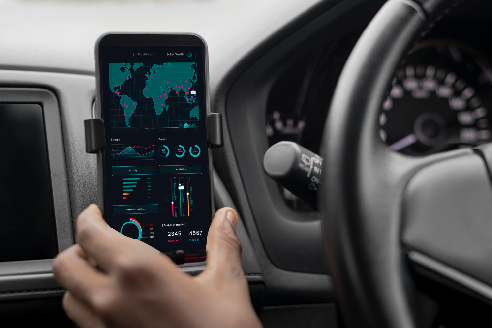
What is Mapping Software for Fleet Tracking
Mapping software is the interface through which fleet managers view GPS data. It translates raw location coordinates into a visual map showing each vehicle’s position, route history and status.
High-quality mapping platforms provide layers such as traffic conditions, weather updates and points of interest relevant to the fleet’s operations.
Many systems allow customisable views, so managers can focus on certain regions, groups of vehicles or time periods.
Mapping software often includes tools for creating geofences, which trigger alerts when a vehicle enters or leaves a defined area.
Integration with routing tools enables managers to plan the most efficient paths and respond quickly to unexpected delays.
The clarity and usability of the mapping interface are key factors in how effectively a fleet manager can make operational decisions.

What is Active vs Passive GPS Tracking
There are two main types of GPS tracking: active and passive:
- Active tracking sends location and performance data to the fleet management platform in real time or at short intervals, allowing managers to monitor vehicles live and react to events as they happen.
- Passive tracking stores data locally on the device and uploads it periodically, usually when the vehicle returns to base. Passive systems are often cheaper and use less data, but they do not offer live monitoring.
Active systems are ideal for time-sensitive operations such as delivery services or emergency response, while passive systems can still provide valuable insights for businesses focused on historical performance analysis rather than immediate intervention.
Choosing between active and passive tracking depends on operational priorities, budget and the level of oversight required.

Can you Explain Real-time Fleet Tracking?
Real-time tracking allows fleet managers to see the current location and movement of vehicles as it happens. This is achieved by GPS devices transmitting frequent updates, sometimes every few seconds, to the fleet management platform via mobile or satellite networks.
Live tracking enables rapid decision-making, such as rerouting a vehicle to avoid traffic or sending the nearest driver to a new job. It also enhances customer service by providing accurate arrival times and immediate updates in case of delays.
For safety, real-time tracking can alert managers to speeding, harsh braking or unauthorised vehicle use.
While it requires more data and power consumption than less frequent updates, the operational benefits often outweigh the extra cost, especially for businesses that rely on quick response and efficient scheduling.

How is GPS Tracking Integrated with Fleet Management Software?
GPS tracking is most effective when integrated with fleet management software, creating a single hub for operational data.
This integration allows location information to be combined with driver schedules, maintenance records and compliance logs.
For example, if a tracking system detects excessive idling, the software can flag this against fuel reports to highlight cost-saving opportunities.
Integration also simplifies administration by automating mileage logs, job completion reports and driver performance reviews.
Many modern systems are cloud-based, enabling managers to access the information from any internet-connected device. This centralised approach ensures that all departments, from dispatch to finance, can work from the same up-to-date data, improving collaboration and overall efficiency.
How Accurate is the GPS in Fleet Tracking?
The accuracy of GPS tracking depends on several factors, including satellite visibility, atmospheric conditions and device quality.
In most urban and suburban areas, modern GPS systems can pinpoint a location to within three to five metres.
Dense buildings, tunnels or heavy foliage can reduce accuracy by blocking satellite signals. To improve performance in challenging environments, many devices use assisted GPS (A-GPS), which supplements satellite data with information from mobile networks.
Some advanced systems also incorporate accelerometers and gyroscopes to estimate movement when GPS signals are temporarily unavailable.
Regular device calibration and proper installation help maintain consistent accuracy. High precision is essential for route optimisation, proof of delivery and compliance reporting, making GPS accuracy a key consideration when choosing a tracking solution.

Is the Data Secure in Fleet Tracking?
Fleet tracking systems collect sensitive information, including vehicle locations, driver behaviour and operational patterns. Protecting this data is critical for privacy, safety and compliance with regulations such as the UK GDPR.
Most providers use encryption during transmission and secure cloud storage to prevent unauthorised access.
Access controls allow only authorised personnel to view or manage tracking data, and audit trails can monitor any changes or access attempts.
Regular software updates are essential to patch security vulnerabilities.
Fleet managers should choose providers with strong data protection policies and ensure that all users follow best practices for password security.
Maintaining data security builds trust with employees and clients while safeguarding the business from cyber threats.

How Do You Troubleshoot GPS Fleet Tracking Issues?
Even the best GPS tracking systems can encounter problems, from signal loss to inaccurate data.
Common causes include poor satellite reception in tunnels or dense urban areas, device power issues, outdated software or SIM card failures in mobile-connected units.
Troubleshooting begins with checking device connections, ensuring it has a clear view of the sky and confirming power supply stability.
Restarting the device or updating its firmware can resolve many issues. If the problem persists, contacting the provider’s technical support is recommended, as they can run remote diagnostics.
Preventative maintenance, such as regular inspections and software updates, helps minimise disruptions. Addressing tracking issues quickly ensures the system continues to deliver reliable data for operational decision-making.
Read our next section: Benefits of GPS Fleet Tracking
Manage Consent
Functional Always active
The technical storage or access is strictly necessary for the legitimate purpose of enabling the use of a specific service explicitly requested by the subscriber or user, or for the sole purpose of carrying out the transmission of a communication over an electronic communications network.
Preferences
The technical storage or access is necessary for the legitimate purpose of storing preferences that are not requested by the subscriber or user.
Statistics
The technical storage or access that is used exclusively for statistical purposes. The technical storage or access that is used exclusively for anonymous statistical purposes. Without a subpoena, voluntary compliance on the part of your Internet Service Provider, or additional records from a third party, information stored or retrieved for this purpose alone cannot usually be used to identify you.
Marketing
The technical storage or access is required to create user profiles to send advertising, or to track the user on a website or across several websites for similar marketing purposes.